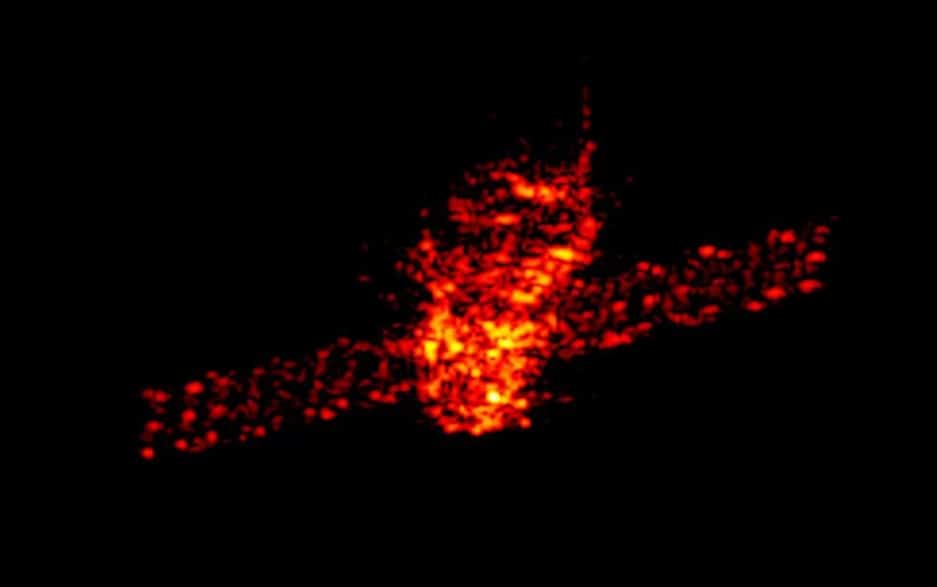
As the Chinese falling space station Tiangong-1 tumbles toward an inevitable breakup in Earth’s atmosphere around Easter weekend (March 30 to April 2), researchers in Germany are keeping a close eye on the station to better predict where and when it will hit.
Scientists at the Fraunhofer Institute for High Frequency Physics and Radar Techniques(Fraunhofer FHR) are monitoring the 8.5-ton (7.7 metric tons) space station module using a tracking and imaging radar system, which they say is one of the most powerful such radars worldwide. Their observations help inform forecasts from the European Space Agency (ESA) and the German Space Situational Awareness Center.
Tiangong-1 was traveling at about 18,000 mph (29,000 km/h) in an orbit nearly 168 miles (270 kilometers) above Earth when the radar images were acquired, according to Fraunhofer FHR. Researchers are also watching the rotation of the station, under a commission from ESA. The rotation is one of the factors in determining when the space station will hit Earth. Tiangong-1 is expected to fall somewhere under its orbital inclination (between 43 degrees north and 43 degrees south latitudes), and some pieces of the space station will make it to the surface.
“A more accurate point of impact can only be estimated a few days previous to the actual event, as the braking effect of the atmosphere is influenced by a number of factors,” Fraunhofer FHR representatives said in a statement. “These include the natural rotation speed, the manner in which Tiangong-1 breaks up into several parts, the time of the break-up and the actual weather conditions in space.”
The institute’s tracking and imaging radar system uses signals in the Ku-band and I-band radio frequencies to track Tiangong-1. Radar allows the institute to watch the station regardless of the weather, or if it is day or night.
“By precisely determining the orbital data of Tiangong-1 until it re-enters at the end of March/beginning of April 2018, FHR offers the German Space Situational Awareness Center valuable support in forecasting the time and place of re-entry,” Fraunhofer FHR representatives said in the statement. “Regular checks are also carried out to establish whether or not Tiangong-1 is still fully intact.”
Large satellites and space stations do occasionally fall back to Earth after operating in space, posing a space debris threat. However, the odds of somebody on the ground getting hit are extremely small.
The most famous example is probably Skylab, a 100-ton (90 metric tons) 1970s-era NASA space station that threw some of its pieces into a remote area east of Perth, Australia, while breaking up in 1979. The Columbia space shuttle broke up in Earth’s atmosphere in February 2003, killing its crew and strewing debris along its re-entry path in the southern United States. More recent examples include ESA’s Gravity Field and Steady-State Ocean Circulation Explorer(GOCE) satellite, which re-entered in November 2013, and NASA’s Upper Atmosphere Research Satellite (UARS), which re-entered in September 2011.
Tiangong-1 was the first Chinese space station. It launched in 2011 and subsequently hosted one robotic spacecraft (Shenzhou 8) and two crews of Chinese astronauts on the Shenzhou 9 and Shenzhou 10 missions that followed.
A successor space station, Tiangong-2, is higher in orbit.It launched in September 2016 and was visited by the crew of Shenzhou 11 later that year.
